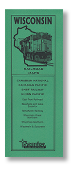
Wisconsin Railroad Maps
$13.50
Handy guide to today's railroads in Wisconsin noted for clarity, accuracy and ease of use. Designed for quick reference in the field in a narrow format that fits in your pocket or camera bag.
Each page highlights a separate subdivision and follows the line throughout its length, crossing state boundaries as necessary. Abandoned or unused routes are also shown in relation to current routes as space allows.
- Detailed maps arranged by subdivision (Sample)
- Class Ones: Canadian National • Canadian Pacific • BNSF Railway • Union Pacific
- Shortlines: East Troy Railroad • Escanaba and Lake Superior • Tomahawk Railroad • Wisconsin Great Northern • Wisconsin Northern • Wisconsin & Southern
- Station index
- Mainline radio frequencies
- Detector, crossover and tunnel locations
- Major highways shown for reference
- Centerspread locator map keyed to page numbers of detail maps
- Printed on heavy ivory-colored stock for reduced glare and increased durability
- 2018 edition
- 48 pages, approx. 4.25 x 11 inches, saddle-stitched
Passenger Route Maps:
Bay Area-Chicago • Seattle-Los Angeles • Seattle/Portland-Chicago
Railroad Maps:
Arizona-New Mexico • California • Colorado-Wyoming • Dakotas • Illinois • Iowa • Minnesota • Montana • Nebraska • Nevada-Utah-So. Idaho • Oregon • Texas • Washington-No. Idaho • Wisconsin