California Railroad Maps
Sorry, out of stock
SORRY, OUT OF STOCK!
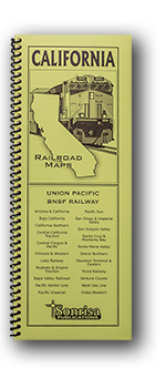
Handy guide to today's railroads in California noted for clarity, accuracy and ease of use. Designed for quick reference in the field in a narrow format that fits in your pocket or camera bag.
Each page highlights a separate subdivision and follows the line throughout its length, crossing state boundaries as necessary. Abandoned or unused routes are also shown in relation to current routes as space allows.
- Detailed maps arranged by subdivision (Sample)
- Class Ones: Union Pacific • BNSF Railway
- Shortlines: Alameda Corridor • Arizona & California • California Northern • Central California Traction • Central Oregon & Pacific • Fillmore & Western • Lake Railway • Modesto & Empire Traction • Napa ValleyNorthwestern Pacific • Pacific Harbor Line • Pacific Imperial • Pacific Sun • San Diego & Imperial Valley • San Joaquin Valley • Santa Cruz & Monterey Bay • Santa Maria Valley • Sierra Northern • Stockton Terminal & Eastern • Trona Railway • Ventura County • West Isle Line • Yreka Western
- Station index
- Mainline radio frequencies
- Detector and tunnel locations
- Major highways shown for reference
- Centerspread locator map keyed to page numbers of detail maps
- Printed on heavy ivory-colored stock for reduced glare and increased durability
- 2022 edition
- 74 pages, approx. 4.25 x 11 inches, coil bound
Passenger Route Maps:
Bay Area-Chicago • Seattle-Los Angeles • Seattle/Portland-Chicago
Railroad Maps:
Arizona-New Mexico • California • Colorado-Wyoming • Dakotas • Illinois • Iowa • Minnesota • Montana • Nebraska • Nevada-Utah-So. Idaho • Oregon • Texas • Washington-No. Idaho • Wisconsin